Integrate Google Maps in your SCADA
Imagine you need your HMI to display the map of your process plants across the world, so that you can control / monitor them via simply clicking on their map locations on screen. Although you can always design the HMI with a stilled map image and labels, but it is always better if you can embed an accurate and dynamic map like Google maps.
Ecava IGX SCADA can achieve what you wish. With the freedom to customize and 100% flexibility, you can now integrate your project with Google Maps easily with only a few lines. We understood your requirements to integrate SCADA with Google Maps, therefore it is possible to implement live data monitoring on Google Maps.
Step 1:
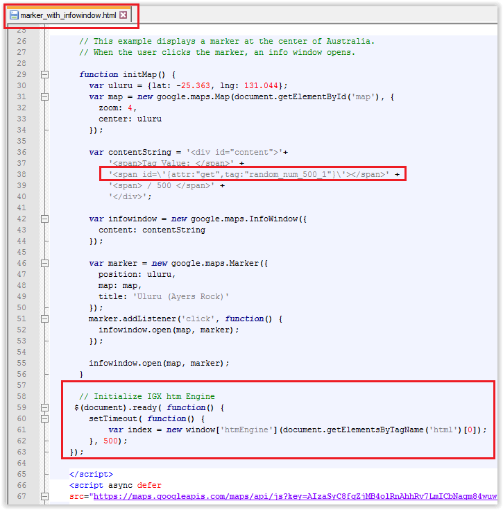
Basically, the integration can be done via a simple javascript function in HTML, for example as shown in screenshot below.

You can display your desired tag(s)’ live data on any coordinates specified on the map. This example function will open an info window when user clicks on the marker on the Google Maps, in which the info window consists of a SCADA tag data.
Step 2:
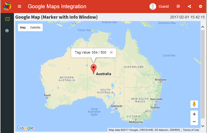
Simply customize and design the HTML file in any way you like, then add it as one of the screens in Ecava IGX Project Editor. Next, just run the project, and from the HMI web browser, navigate to the map page which you have added. For this example, the outcome will be as shown in screenshot below.

